Author: ar2008853@gmail.com

  • Winter Storm Warning in the United States: Forecast, Risks, and Safety Guide

    Winter Storm Warning in the United States: Forecast, Risks, and Safety Guide

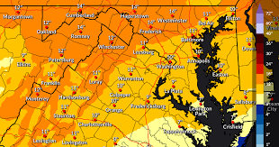
    Winter storms are among the most significant weather events in the United States, impacting millions of residents every year. From heavy snowfall and freezing rain to ice accumulation and strong winds, these storms can disrupt transportation, cause power outages, and create hazardous conditions. Understanding winter storm warnings is crucial for safety, preparation, and planning.

    This detailed guide explains what a winter storm warning is, typical weather patterns, expected impacts, and essential safety tips.


    What Is a Winter Storm Warning?

    A Winter Storm Warning is issued by the National Weather Service (NWS) when severe winter weather is imminent or occurring. This warning indicates that conditions are expected to pose significant threats to life and property, including:

    • Heavy snowfall
    • Ice accumulation
    • Freezing rain
    • Strong winds and blizzard conditions

    Winter storm warnings are usually issued 12–36 hours before the event, giving residents time to prepare.


    Types of Winter Storm Hazards

    1. Snowfall

    Heavy snow can reduce visibility, slow traffic, and cause road closures. Snow accumulation varies depending on location, with northern and midwestern states often receiving the highest amounts.

    2. Freezing Rain

    Freezing rain occurs when rain falls onto surfaces below 32°F, forming a layer of ice. This can:

    • Make roads extremely slippery
    • Cause tree limbs to break
    • Lead to power outages

    3. Sleet

    Sleet is small ice pellets that bounce on contact and can accumulate on roads, making travel hazardous.

    4. Blizzard Conditions

    A blizzard is more severe than a standard snowstorm and is defined by:

    • Sustained winds ≥35 mph
    • Visibility <¼ mile
    • Duration ≥3 hours

    Blizzards are common in the Midwest and northern plains.


    Regions Most Affected by Winter Storms

    Winter storms can impact nearly every region, but certain areas are particularly vulnerable:

    • Northeast: Heavy snow, nor’easters, ice storms
    • Midwest: Snow, sleet, blizzards, ice accumulation
    • Southeast: Occasional freezing rain and sleet
    • Rocky Mountains: Heavy snow in mountainous terrain
    • Northern Plains: Strong blizzards and extreme cold

    Coastal storms, called nor’easters, can produce significant snowfall, coastal flooding, and strong winds along the Atlantic coast.


    Seasonal Winter Storm Patterns

    Early Winter (December)

    • First major snowfalls in northern states
    • Occasional ice storms in southern states

    Mid-Winter (January – February)

    • Peak winter storm activity in the Midwest and Northeast
    • Arctic air masses cause extreme cold

    Late Winter (March)

    • Snowstorms still possible in northern regions
    • Transition to spring can create mixed precipitation events

    Impacts of Winter Storms

    Winter storms can affect daily life in multiple ways:

    1. Transportation Disruption – Road closures, flight delays, and train service interruptions.
    2. Power Outages – Ice accumulation on power lines can knock out electricity for hours or days.
    3. Property Damage – Fallen trees, roof collapses under heavy snow, and flooding from melting snow.
    4. Health Risks – Hypothermia, frostbite, and accidents due to slippery conditions.

    Winter Storm Warning vs. Winter Weather Advisory

    • Winter Storm Warning: Dangerous winter weather is imminent or occurring; significant impacts expected.
    • Winter Weather Advisory: Winter conditions are less severe, but may still cause inconvenience.

    Warnings require immediate attention, while advisories are more precautionary.


    How to Prepare for a Winter Storm

    1. Monitor Weather Updates

    • Follow the NWS, local news, and weather apps for alerts.

    2. Prepare Your Home

    • Stock up on food, water, and emergency supplies
    • Insulate pipes to prevent freezing
    • Keep flashlights, batteries, and heating options ready

    3. Travel Safety

    • Avoid unnecessary travel during warnings
    • Keep a winter emergency kit in your vehicle (blankets, food, water, shovel)
    • Drive cautiously on icy roads

    4. Protect Pets and Vulnerable Individuals

    • Keep pets indoors during extreme cold
    • Check on elderly neighbors or anyone at risk

    Frequently Asked Questions

    What snowfall triggers a winter storm warning?

    It varies by region, but typically 6+ inches of snow in 12 hours, or 8+ inches in 24 hours. Ice accumulation or blizzard conditions can also trigger warnings.

    Are winter storm warnings issued nationwide?

    Yes, the NWS issues warnings for all states that may be affected by severe winter weather.

    How long does a winter storm last?

    Winter storms can last from several hours to multiple days, depending on size and speed.

    Can winter storms cause tornadoes?

    Rarely, but winter storms can create severe weather on their southern edges, especially in the Southeast.

    How can I get real-time updates?

    Follow the NWS website, local TV stations, or mobile weather alerts.


    Final Thoughts

    Winter storm warnings are critical for safety during the harsh winter months. Heavy snow, ice, freezing rain, and blizzard conditions can create dangerous situations if unprepared.

    Residents and travelers should monitor forecasts closely, avoid travel when possible, and ensure their homes and vehicles are ready for extreme cold. With proper preparation and awareness, the risks posed by winter storms in the United States can be minimized.

  • Miami Rain Forecast This Week: Weather Outlook, Patterns, and Safety Tips

    Miami Rain Forecast This Week: Weather Outlook, Patterns, and Safety Tips

    Miami, Florida, is famous for its tropical climate, with warm temperatures and high humidity year-round. Rainfall is a key aspect of Miami weather, especially during the wet season, which spans from May through October. Understanding the Miami rain forecast this week is important for residents, travelers, and businesses planning outdoor activities or events.

    This comprehensive guide explains daily rain predictions, seasonal patterns, causes of heavy rainfall, and practical tips to stay safe and prepared.


    Overview of Miami’s Climate

    Miami has a tropical monsoon climate, characterized by:

    • Hot, humid summers
    • Mild, dry winters
    • Frequent rainfall during wet season
    • Occasional thunderstorms and tropical storms

    The city’s location along the Atlantic coast and proximity to the Everglades contributes to daily weather fluctuations, including sudden rain showers.


    Miami Rain Forecast This Week

    Daily rainfall in Miami can vary based on local conditions, sea breeze effects, and tropical systems. Typical weather features include:

    • Afternoon or evening thunderstorms
    • Brief but heavy downpours
    • High humidity levels
    • Warm temperatures even during rainy periods

    During the wet season, it’s common for showers to develop quickly and dissipate within an hour, although some storms can be more persistent.


    Temperature and Rainfall Patterns

    Summer (May to October)

    • Average daytime temperatures: 85°F–92°F
    • Humidity: 70%–80%
    • Rainfall: Most frequent during afternoons
    • Thunderstorms: Common due to sea breeze convergence

    Winter (November to April)

    • Average daytime temperatures: 70°F–80°F
    • Lower humidity and rainfall
    • Dry season, with occasional showers

    Miami’s tropical climate means that rain can occur any time of year, but the wet season produces the most significant weekly rainfall.


    Causes of Miami Rain

    1. Sea Breezes

    During hot summer days, the combination of warm land and cooler ocean water causes sea breezes, which can lead to:

    • Afternoon thunderstorms
    • Localized heavy rain

    2. Tropical Storms and Hurricanes

    Between June and November, tropical systems may bring:

    • Prolonged rainfall
    • Strong winds
    • Flooding in low-lying areas

    3. Atmospheric Disturbances

    Weather systems moving across the Gulf of Mexico or Caribbean can also trigger rainfall in Miami, sometimes resulting in multiple rainy days within a single week.


    Thunderstorms and Lightning

    Miami frequently experiences afternoon thunderstorms, particularly in summer. Key points include:

    • Lightning is a common hazard
    • Heavy downpours can reduce visibility on roads
    • Flash flooding may occur in certain neighborhoods

    Residents should monitor the National Weather Service (NWS) alerts for lightning and flood warnings.


    Flooding Risks in Miami

    Due to low elevation and high rainfall, Miami is prone to:

    • Street flooding during heavy rain
    • Flooded basements or low-lying homes
    • Traffic disruptions

    High tides combined with rain events can worsen flooding in coastal areas.


    Air Quality During Rain

    Rain can temporarily improve air quality by clearing pollutants from the atmosphere. However, high humidity can make the air feel sticky and uncomfortable.


    Tips for Preparing for Rain This Week

    1. Check daily forecasts – Use NWS or local weather apps for real-time updates.
    2. Carry an umbrella or raincoat – Afternoon showers can occur suddenly.
    3. Plan outdoor activities carefully – Schedule events in the morning if heavy rain is expected later.
    4. Drive safely in wet conditions – Reduce speed and allow extra distance between vehicles.
    5. Avoid flooded areas – Even shallow water can be hazardous for vehicles and pedestrians.

    Weekly Rain Outlook Example

    A typical week during Miami’s wet season may include:

    DayForecastTemperatureRain ProbabilityNotes
    MondayPartly cloudy, afternoon showers88°F40%Light rainfall, short duration
    TuesdayThunderstorms90°F70%Heavy downpours possible, high humidity
    WednesdaySunny intervals87°F20%Minimal rain, cooler morning
    ThursdayScattered storms89°F50%Localized heavy rainfall
    FridayThunderstorms91°F65%Potential flooding in low areas
    SaturdayMostly sunny88°F10%Dry day, pleasant conditions
    SundayAfternoon showers87°F40%Brief rain, evening clears

    This is an example; actual conditions may vary based on tropical systems and atmospheric disturbances.


    Frequently Asked Questions

    Does it rain every day in Miami?

    No, rain is common during the wet season, especially afternoons, but not every day sees rainfall.

    When is Miami’s wet season?

    May through October is the wet season, with the highest rainfall typically in June, July, and September.

    Can Miami experience flash floods?

    Yes, heavy downpours and poor drainage in low-lying areas can cause flash flooding.

    Are thunderstorms dangerous in Miami?

    Yes. Lightning is a significant risk, and strong storms can reduce visibility and cause localized flooding.

    How can I check Miami’s rain forecast in real time?

    Use the National Weather Service, local news channels, or reliable weather apps.


    Final Thoughts

    Miami rain forecasts are essential for residents, travelers, and businesses planning daily activities. Sudden thunderstorms, high humidity, and occasional flash floods require preparedness and caution.

    Monitoring the weekly forecast, carrying rain protection, and avoiding flooded areas ensures safety and convenience. Whether planning outdoor events, commuting, or simply enjoying the city, staying updated on Miami’s rain conditions is key to navigating the tropical climate efficiently.

  • California Wildfire Weather Conditions Explained: Causes, Risks, and Forecast Factors

    California Wildfire Weather Conditions Explained: Causes, Risks, and Forecast Factors

    California is one of the most wildfire-prone states in the United States. Each year, millions of acres are affected by fires that are often intensified by specific weather conditions. Understanding California wildfire weather conditions is essential for residents, property owners, and travelers who want to stay informed and prepared.

    This comprehensive guide explains the weather patterns that fuel wildfires in California, how forecasts predict fire risk, and what safety measures should be taken during high-risk periods.

    Why California Is Highly Vulnerable to Wildfires

    California’s wildfire risk is influenced by a combination of:

    • Prolonged dry seasons
    • Hot temperatures
    • Strong seasonal winds
    • Mountainous terrain
    • Dense vegetation

    The state’s Mediterranean climate features wet winters and long, dry summers. During summer and fall, vegetation becomes extremely dry, creating ideal fuel for fires.

    Key Weather Conditions That Increase Wildfire Risk

    Several weather factors significantly increase wildfire danger in California.

    1. High Temperatures

    Hot weather dries out grass, shrubs, and forests. When temperatures rise above normal for extended periods, moisture evaporates quickly from vegetation, making it highly flammable.

    Heatwaves can accelerate fire spread once a fire starts.

    2. Low Humidity

    Humidity measures the amount of moisture in the air. Low humidity levels—often below 20 percent—create extremely dry conditions.

    Dry air allows fires to ignite easily and spread rapidly.

    3. Strong Winds

    Wind is one of the most dangerous wildfire factors. Strong winds can:

    • Carry embers over long distances
    • Spread flames rapidly
    • Change fire direction suddenly

    In California, certain seasonal wind events significantly increase fire risk.

    Santa Ana and Diablo Winds

    Two major wind systems contribute to wildfire conditions:

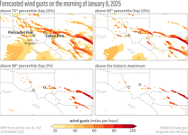
    Santa Ana Winds (Southern California)

    • Typically occur in fall and winter
    • Bring hot, dry air from inland deserts
    • Can reach high speeds
    • Dramatically lower humidity

    These winds are often associated with major wildfire outbreaks.

    Diablo Winds (Northern California)

    • Occur mainly in fall
    • Bring dry, gusty conditions
    • Increase fire spread potential

    When combined with dry vegetation, these winds create extremely dangerous fire weather conditions.

    Drought and Dry Vegetation

    California frequently experiences drought cycles. During drought:

    • Soil moisture levels drop
    • Trees and plants become stressed
    • Dead vegetation accumulates

    Dry fuel increases the likelihood of ignition and rapid fire growth.

    Long-term drought conditions have been linked to larger and more intense wildfires.

    Lightning Storms

    Although less common than wind-driven fires, lightning can ignite wildfires, especially during dry thunderstorms.

    Dry lightning storms produce minimal rainfall but generate lightning strikes capable of starting multiple fires at once.

    These events have caused significant wildfire outbreaks in Northern California.

    Fire Weather Warnings and Red Flag Alerts

    The National Weather Service issues specific alerts during high-risk conditions.

    Red Flag Warning

    A Red Flag Warning indicates:

    • Strong winds
    • Low humidity
    • Warm temperatures
    • Critical fire weather conditions

    During a Red Flag Warning, outdoor burning and certain activities may be restricted.

    Fire Weather Watch

    This alert is issued when critical conditions are possible in the near future.

    Residents should monitor forecasts closely during these alerts.

    Seasonal Wildfire Patterns in California

    Summer (June to August)

    • Hot temperatures
    • Very dry vegetation
    • Increased wildfire activity

    Fall (September to November)

    • Peak wildfire season in many areas
    • Santa Ana and Diablo winds
    • Extremely low humidity

    Winter (December to February)

    • Rain reduces fire risk
    • However, dry winters can extend wildfire season

    Spring (March to May)

    • Moderate risk depending on rainfall patterns

    In recent years, wildfire season has extended beyond traditional timeframes due to changing climate patterns.

    Climate Change and Wildfire Intensity

    Research indicates that climate change is contributing to:

    • Higher average temperatures
    • Longer dry seasons
    • Increased frequency of heatwaves
    • Reduced snowpack in mountain regions

    These changes result in longer wildfire seasons and more intense fires.

    Warmer conditions also increase the likelihood of rapid fire spread.

    Impact of Wildfire Weather on Air Quality

    Wildfires significantly affect air quality across California.

    Smoke can:

    • Travel hundreds of miles
    • Increase particulate matter in the air
    • Trigger respiratory issues

    Air Quality Index (AQI) levels may rise to unhealthy or hazardous categories during active fire events.

    Sensitive individuals, including children and older adults, are particularly vulnerable.

    How Fire Behavior Is Forecasted

    Meteorologists use several tools to forecast wildfire conditions:

    • Weather models
    • Satellite imagery
    • Wind speed predictions
    • Fuel moisture measurements
    • Temperature and humidity trends

    These forecasts help emergency services prepare resources and issue public warnings.

    How to Prepare During High Fire Weather

    When wildfire weather conditions are elevated:

    1. Create a Defensible Space

    Clear dry vegetation around homes to reduce fire risk.

    2. Prepare an Emergency Kit

    Include:

    • Water and non-perishable food
    • Flashlights and batteries
    • Important documents
    • Face masks for smoke protection

    3. Have an Evacuation Plan

    Know evacuation routes and keep vehicles fueled.

    4. Monitor Official Alerts

    Follow updates from:

    • National Weather Service
    • CAL FIRE
    • Local emergency management agencies

    Travel Considerations During Wildfire Season

    Travelers should:

    • Check fire maps before visiting affected regions
    • Monitor road closures
    • Be aware of air quality advisories
    • Have flexible travel plans

    Wildfires can impact highways, parks, and outdoor recreation areas.

    Frequently Asked Questions

    What weather causes wildfires in California?

    High temperatures, low humidity, strong winds, and dry vegetation create ideal wildfire conditions.

    When is wildfire season in California?

    Peak season typically occurs in summer and fall, though fires can happen year-round.

    What is a Red Flag Warning?

    It is an alert indicating critical fire weather conditions that increase wildfire risk.

    Do wildfires only happen in forests?

    No. Grasslands, shrublands, and urban-wildland areas are also vulnerable.

    Is wildfire season getting longer?

    Recent trends suggest that wildfire season has expanded due to warmer and drier conditions.

    Final Thoughts

    California wildfire weather conditions are driven by a complex combination of heat, drought, wind, and low humidity. Seasonal wind events such as Santa Ana and Diablo winds play a major role in increasing fire danger, especially during fall.

    As climate patterns evolve, wildfire seasons have become longer and more intense. Staying informed about Red Flag Warnings, monitoring forecasts, and preparing emergency plans are essential steps for protecting lives and property.

    Understanding how weather influences wildfire behavior helps residents and visitors make safer decisions during high-risk periods.

  • Texas Heatwave Alert: Record-Breaking Temperatures, Causes, and Safety Guide

    Texas Heatwave Alert: Record-Breaking Temperatures, Causes, and Safety Guide

    Texas is no stranger to extreme heat. During peak summer months, large parts of the state experience prolonged periods of high temperatures that trigger official heatwave alerts. From Dallas and Houston to Austin and San Antonio, record-breaking heat has become a growing concern for residents, businesses, and public health officials.

    This detailed guide explains what a Texas heatwave alert means, why extreme temperatures occur, how long they typically last, and how to stay safe during dangerous heat conditions.

    What Is a Heatwave?

    A heatwave is a prolonged period of excessively hot weather, often combined with high humidity. In Texas, a heatwave is typically declared when:

    • Temperatures remain significantly above average for several consecutive days
    • Heat index values exceed safe thresholds
    • Overnight temperatures remain unusually high

    The heat index measures how hot it feels when humidity is combined with air temperature. In many Texas cities, the heat index can exceed 105°F or even 110°F during severe heat events.

    Why Texas Experiences Extreme Heat

    Several factors contribute to intense heat in Texas:

    1. Geographic Location

    Texas is located in the southern United States, where strong summer sun and high solar radiation naturally increase temperatures.

    2. High-Pressure Systems

    Persistent high-pressure systems, often called “heat domes,” trap hot air over the region. These systems prevent cloud formation and rainfall, allowing temperatures to climb for days or weeks.

    3. Dry Soil Conditions

    Drought conditions can intensify heatwaves. When soil moisture is low, more solar energy goes into heating the air rather than evaporating water, increasing surface temperatures.

    4. Urban Heat Island Effect

    Large cities like Houston and Dallas experience higher temperatures due to concrete, asphalt, and limited green space. Urban areas can remain significantly warmer at night compared to rural regions.

    Record-Breaking Temperatures in Texas

    Texas has recorded some of the highest temperatures in U.S. history. During extreme heat events:

    • Daytime highs often exceed 100°F
    • Some areas reach 105°F to 110°F
    • Overnight temperatures may stay above 80°F

    When nights remain hot, the body has less opportunity to cool down, increasing the risk of heat-related illnesses.

    Extended heatwaves can break long-standing temperature records, especially during July and August.

    Cities Most Affected by Heatwaves

    While heat impacts the entire state, some cities frequently experience extreme conditions:

    • Dallas–Fort Worth: Often sees triple-digit temperatures during summer.
    • Houston: High humidity increases heat index values.
    • Austin: Regularly experiences prolonged dry heat.
    • San Antonio: Extended periods of high temperatures are common.
    • West Texas (El Paso, Midland): Very hot and dry desert conditions.

    Coastal areas may experience slightly lower air temperatures but higher humidity.

    Dangers of Extreme Heat

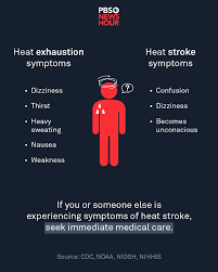
    Heatwaves pose serious health risks, including:

    Heat Exhaustion

    Symptoms include:

    • Heavy sweating
    • Weakness
    • Dizziness
    • Nausea
    • Headache

    Heat Stroke

    Heat stroke is a medical emergency and may cause:

    • Body temperature above 103°F
    • Confusion or unconsciousness
    • Rapid pulse
    • Hot, dry skin

    Immediate medical attention is required for heat stroke.

    Impact of Heatwaves on Infrastructure

    Extreme heat affects more than just personal comfort. It also impacts:

    • Power grids due to increased air conditioning demand
    • Road surfaces, which may buckle under high temperatures
    • Water supply systems during drought conditions
    • Agriculture and livestock

    Power outages during heatwaves can create dangerous situations, especially for vulnerable populations.

    Climate Change and Rising Temperatures

    Research indicates that climate change is contributing to:

    • More frequent heatwaves
    • Longer-lasting extreme heat events
    • Higher average summer temperatures
    • Increased nighttime temperatures

    Texas has experienced several consecutive years of above-average summer heat, raising concerns about long-term trends.

    How Long Do Texas Heatwaves Last?

    Heatwaves in Texas can last:

    • Several days
    • One to two weeks
    • Occasionally longer during persistent high-pressure systems

    The most intense heat usually occurs between late June and early September.

    Heatwave Safety Tips

    Staying safe during a Texas heatwave requires proactive measures.

    1. Stay Hydrated

    Drink plenty of water, even if you do not feel thirsty. Avoid excessive caffeine and alcohol.

    2. Limit Outdoor Activity

    Avoid strenuous activity during peak afternoon hours (usually 12 PM to 5 PM).

    3. Use Air Conditioning

    Stay in air-conditioned spaces whenever possible. Public cooling centers may be available during extreme heat alerts.

    4. Wear Lightweight Clothing

    Choose light-colored, loose-fitting clothing to allow proper airflow.

    5. Check on Vulnerable Individuals

    Elderly individuals, young children, and those with medical conditions are at higher risk.

    6. Never Leave Children or Pets in Vehicles

    Car interiors can reach life-threatening temperatures within minutes.

    Heat Alerts and Warnings

    The National Weather Service may issue:

    • Heat Advisories
    • Excessive Heat Warnings
    • Excessive Heat Watches

    These alerts indicate dangerous heat conditions and should not be ignored.

    Residents are encouraged to monitor local weather updates and emergency notifications.

    Preparing Your Home for Extreme Heat

    To reduce heat-related risks:

    • Install energy-efficient insulation
    • Use blackout curtains to block sunlight
    • Service air conditioning systems before summer
    • Install ceiling fans to improve air circulation

    Energy conservation measures may also help prevent strain on the power grid.

    Frequently Asked Questions

    What temperature qualifies as a heatwave in Texas?

    There is no fixed number, but prolonged temperatures significantly above average—often above 100°F—typically trigger heat alerts.

    Why does Texas feel hotter than the actual temperature?

    High humidity increases the heat index, making it feel hotter than the measured air temperature.

    When is the hottest month in Texas?

    July and August are typically the hottest months.

    Are Texas heatwaves becoming more common?

    Recent data suggests that heatwaves are increasing in frequency and duration.

    How can I stay updated during a heatwave?

    Monitor updates from the National Weather Service and local authorities.

    Final Thoughts

    Texas heatwave alerts signal potentially dangerous weather conditions that require serious attention. Record-breaking temperatures, high humidity, and prolonged dry periods can pose health risks and strain infrastructure.

    Understanding the causes of extreme heat, recognizing warning signs of heat-related illness, and taking preventive measures can significantly reduce risks. As Texas continues to face intense summer conditions, preparation and awareness remain essential for staying safe during record-breaking heat events.

  • Florida Hurricane Season 2026: Predictions, Preparedness, and What to Expect

    Florida Hurricane Season 2026: Predictions, Preparedness, and What to Expect

    Florida is one of the most hurricane-prone states in the United States. Due to its geographic location between the Atlantic Ocean and the Gulf of Mexico, the state faces a significant risk of tropical storms and hurricanes every year. As the 2026 hurricane season approaches, residents, businesses, and travelers are closely monitoring forecasts and long-range predictions.

    This comprehensive guide covers the Florida Hurricane Season 2026 outlook, how hurricane predictions are made, expected activity patterns, historical trends, and essential preparedness strategies.

    When Is Hurricane Season in Florida?

    The official Atlantic hurricane season runs from June 1 through November 30, with peak activity typically occurring between August and October.

    Florida’s long coastline makes it vulnerable to storms developing in:

    • The Atlantic Ocean
    • The Caribbean Sea
    • The Gulf of Mexico

    Because warm ocean waters fuel hurricanes, late summer and early fall are usually the most active months.

    How Hurricane Predictions Are Made

    Hurricane season predictions are based on multiple climate indicators and atmospheric conditions. Meteorologists and research institutions analyze:

    • Sea surface temperatures in the Atlantic
    • El Niño and La Niña patterns
    • Wind shear levels
    • Historical storm cycles
    • Atmospheric pressure systems

    El Niño vs. La Niña Impact

    • El Niño years often reduce Atlantic hurricane activity due to stronger wind shear that disrupts storm formation.
    • La Niña years typically increase hurricane activity because wind shear is weaker, allowing storms to strengthen.

    Long-range seasonal forecasts estimate the number of named storms, hurricanes, and major hurricanes expected during the season. However, they cannot predict exactly where storms will make landfall.

    Florida Hurricane Season 2026: Expected Activity Patterns

    While exact storm numbers vary from year to year, Florida generally prepares for:

    • Multiple named tropical storms
    • Several hurricanes
    • At least one major hurricane risk

    A “major hurricane” is classified as Category 3 or higher on the Saffir-Simpson Hurricane Wind Scale, with sustained winds of 111 mph or greater.

    Even in average seasons, Florida can experience significant impacts from a single storm.

    Why Florida Is Highly Vulnerable

    Florida’s vulnerability is due to:

    • Over 1,300 miles of coastline
    • Low elevation in many coastal areas
    • Warm surrounding waters
    • High population density

    Major cities such as Miami, Tampa, Orlando, and Jacksonville face different levels of risk depending on storm tracks.

    Storm surge is often the most dangerous threat, especially in coastal communities.

    Types of Storms That Affect Florida

    Tropical Depression

    The earliest stage of storm development, with winds below 39 mph.

    Tropical Storm

    Winds between 39 and 73 mph. These storms are given official names.

    Hurricane

    Winds of 74 mph or higher. Hurricanes are divided into five categories:

    • Category 1: 74–95 mph
    • Category 2: 96–110 mph
    • Category 3: 111–129 mph
    • Category 4: 130–156 mph
    • Category 5: 157+ mph

    Even Category 1 storms can cause significant flooding and wind damage.

    Historical Hurricane Trends in Florida

    Historically, Florida has experienced some of the most destructive hurricanes in U.S. history. Over the decades, trends have shown:

    • Increasing coastal development
    • Rising sea levels
    • Higher rainfall rates during storms

    While the total number of storms may vary, the intensity of hurricanes has become a growing concern.

    Some regions, particularly South Florida and the Gulf Coast, face higher landfall frequency.

    Major Threats During Hurricane Season

    Storm Surge

    Storm surge is the abnormal rise of seawater caused by hurricane winds pushing water toward shore. It can:

    • Flood coastal neighborhoods
    • Damage infrastructure
    • Cause life-threatening conditions

    Storm surge is often more dangerous than wind damage.

    Heavy Rainfall and Flooding

    Hurricanes can produce several inches of rain within hours, leading to:

    • Flash floods
    • River overflow
    • Urban flooding

    Even inland cities like Orlando can experience significant flooding.

    High Winds

    Strong winds can:

    • Damage roofs
    • Knock down trees
    • Cause widespread power outages

    Wind damage often extends far from the storm’s center.

    Tornadoes

    Hurricanes can spawn tornadoes, especially as they make landfall.

    Climate Change and Hurricane Intensity

    Scientists continue to study how climate change influences hurricane patterns. Research suggests:

    • Warmer ocean temperatures may fuel stronger storms
    • Rainfall rates are increasing in some hurricanes
    • Rapid intensification events are becoming more common

    Rapid intensification occurs when a storm strengthens dramatically within a short period, reducing preparation time.

    How to Prepare for Florida Hurricane Season 2026

    Preparation is essential before the season begins.

    1. Create an Emergency Plan

    Families should:

    • Identify evacuation routes
    • Designate a safe meeting location
    • Keep emergency contacts updated

    2. Build a Hurricane Supply Kit

    A basic emergency kit should include:

    • Non-perishable food for at least 3 days
    • Bottled water
    • Flashlights and batteries
    • First aid supplies
    • Portable phone chargers
    • Important documents in waterproof containers

    3. Review Insurance Coverage

    Homeowners should verify:

    • Flood insurance coverage
    • Windstorm insurance details
    • Deductibles and claim procedures

    Flood damage is not typically covered under standard homeowner policies.

    4. Protect Your Property

    Before a storm approaches:

    • Install hurricane shutters
    • Secure outdoor furniture
    • Trim trees and branches
    • Clear gutters and drains

    5. Monitor Official Updates

    Residents should rely on:

    • National Hurricane Center (NHC)
    • National Weather Service (NWS)
    • Local emergency management offices

    Avoid relying solely on social media for storm updates.

    Evacuation Considerations

    Evacuations may be ordered in high-risk areas. If officials issue an evacuation order:

    • Leave immediately
    • Follow designated routes
    • Avoid flooded roads
    • Bring essential supplies

    Delaying evacuation can lead to dangerous traffic congestion and limited shelter availability.

    Travel During Hurricane Season

    Tourists visiting Florida during hurricane season should:

    • Purchase travel insurance
    • Monitor forecasts daily
    • Understand hotel cancellation policies
    • Have backup travel plans

    While most days during hurricane season are calm, storms can disrupt travel quickly.

    Frequently Asked Questions

    Is Florida guaranteed to be hit by a hurricane every year?

    No. While Florida frequently faces hurricane threats, not every year results in a direct landfall.

    What is the peak month for hurricanes in Florida?

    September is typically the most active month.

    How early should I prepare?

    Preparation should begin before June 1, the official start of the season.

    Can hurricanes affect inland Florida cities?

    Yes. Inland areas can experience heavy rain, flooding, and strong winds.

    Are hurricane predictions always accurate?

    Seasonal forecasts estimate activity levels but cannot predict exact storm paths months in advance.

    Final Thoughts

    Florida Hurricane Season 2026 will require careful monitoring, preparation, and awareness. While meteorologists can estimate overall storm activity, the exact timing and location of storms remain unpredictable until systems develop.

    Because Florida’s geography makes it highly vulnerable, residents and visitors should prioritize early preparation. Understanding storm categories, monitoring official alerts, and maintaining emergency supplies are essential steps for staying safe.

    Hurricanes are a natural part of Florida’s climate, but proactive planning and reliable information can significantly reduce risk and damage.

  • Chicago Weather Alert: Snowstorm Warning, Winter Forecast, and Safety Guide

    Chicago is widely known for its dramatic weather changes, especially during the winter season. Located along the shores of Lake Michigan, the city experiences intense snowstorms, freezing temperatures, and powerful winds. When a Chicago weather alert is issued—particularly for a snowstorm—it is important for residents and travelers to stay informed and prepared.

    This comprehensive guide explains snowstorm warnings in Chicago, winter weather patterns, expected snowfall, temperature trends, and safety precautions.

    Why Chicago Experiences Severe Winter Weather

    Chicago has a humid continental climate, which means:

    • Cold winters
    • Hot summers
    • Significant seasonal variation
    • Frequent snowstorms

    The city’s location near Lake Michigan plays a major role in its winter weather. Cold Arctic air masses often move southward into the Midwest, colliding with moisture from the Great Lakes. This combination can create heavy snowfall and strong winds.

    What Is a Snowstorm Warning in Chicago?

    A snowstorm warning, often issued by the National Weather Service (NWS), indicates that:

    • Heavy snowfall is expected
    • Dangerous travel conditions are likely
    • Strong winds may reduce visibility
    • Rapid temperature drops could occur

    Warnings are typically issued when snowfall is expected to reach significant accumulation levels within a short period.

    Residents should take these alerts seriously, as snowstorms in Chicago can disrupt transportation, close schools, and affect businesses.

    Typical Snowfall in Chicago

    On average, Chicago receives around 35 to 40 inches of snow per year. However, totals can vary significantly from one winter to another.

    Major snowstorms can bring:

    • 6 inches or more in a single event
    • Blizzard conditions with near-zero visibility
    • Wind gusts exceeding 35 mph

    Lake-effect snow can intensify snowfall in certain areas, especially near the lakefront.

    Lake-Effect Snow Explained

    Lake-effect snow occurs when cold air moves over the relatively warmer waters of Lake Michigan. The moisture from the lake rises into the cold air and forms snow clouds.

    This process can lead to:

    • Sudden heavy snowfall
    • Localized snow bands
    • Rapid accumulation in specific neighborhoods

    Some areas may receive significantly more snow than others within the same city.

    Winter Temperature Trends in Chicago

    Winter temperatures in Chicago typically range from:

    • 18°F to 32°F during the day
    • Single digits or below 0°F during extreme cold waves

    Wind chill often makes it feel much colder. Strong winds coming off Lake Michigan can create dangerous conditions.

    Polar vortex events sometimes bring extremely low temperatures for several consecutive days.

    Impact of Snowstorms on Chicago

    When a snowstorm warning is active, the city may experience:

    • Flight delays at O’Hare and Midway airports
    • Public transit slowdowns
    • Road closures
    • School cancellations
    • Power outages in severe cases

    The city is well-equipped with snowplows and salt trucks, but heavy accumulation can still cause disruptions.

    How to Prepare for a Chicago Snowstorm

    Preparation is essential when a weather alert is issued. Residents should:

    1. Monitor official weather updates from trusted sources.
    2. Keep emergency supplies at home, including food, water, and flashlights.
    3. Ensure vehicles are winter-ready with proper tires and antifreeze.
    4. Avoid unnecessary travel during peak snowfall.
    5. Dress in warm, layered clothing when going outside.

    Winter clothing should include insulated jackets, gloves, hats, and waterproof boots.

    Driving Safety During Snowstorms

    Driving in snowy conditions can be dangerous. Important safety tips include:

    • Reduce speed significantly
    • Maintain a safe distance from other vehicles
    • Avoid sudden braking
    • Keep headlights on
    • Carry an emergency car kit

    Black ice can form when temperatures fluctuate around freezing, making roads extremely slippery.

    Blizzard Conditions in Chicago

    A blizzard is more severe than a typical snowstorm. It involves:

    • Sustained winds of 35 mph or higher
    • Visibility less than a quarter mile
    • Conditions lasting at least three hours

    Blizzards are rare but have historically impacted Chicago, causing major disruptions.

    Climate Change and Chicago Winter Weather

    Climate patterns are gradually changing. Studies show:

    • Slightly warmer average winter temperatures
    • Increased frequency of heavy precipitation events
    • Shifts in snowfall timing

    While winters may become milder overall, intense snowstorms can still occur due to changing atmospheric patterns.

    When Is Chicago’s Snowiest Period?

    The snowiest months in Chicago are typically:

    • January
    • February

    December and March can also experience significant snowfall, but accumulation varies.

    Best Practices During a Weather Alert

    When a Chicago weather alert is issued:

    • Stay indoors if possible
    • Check for updates every few hours
    • Follow local government advisories
    • Prepare for possible power outages

    Mobile weather apps and emergency notification systems provide real-time updates.

    Frequently Asked Questions (FAQ)

    How much snow triggers a snowstorm warning in Chicago?

    Warnings are usually issued when heavy snowfall and dangerous travel conditions are expected, often around 6 inches or more within a short time frame.

    Does Chicago get blizzards often?

    Blizzards are less frequent than standard snowstorms but can occur under specific wind and snowfall conditions.

    What is lake-effect snow?

    Lake-effect snow happens when cold air moves over Lake Michigan, creating localized heavy snowfall.

    How cold does Chicago get in winter?

    Temperatures can drop below 0°F during extreme cold waves, especially with wind chill.

    Are snowstorms common in Chicago?

    Yes, snowstorms are a regular part of winter weather in Chicago.

    Final Thoughts

    Chicago weather alerts, especially snowstorm warnings, are a serious matter during winter months. The combination of heavy snowfall, strong winds, and freezing temperatures can create hazardous conditions across the city.

    Understanding how snowstorms form, monitoring official forecasts, and preparing in advance are essential steps to staying safe. Whether commuting to work, managing a business, or traveling through the city, staying informed about Chicago’s winter weather ensures better planning and protection.

  • Los Angeles 7-Day Weather Forecast: Complete Climate Guide and Weekly Outlook

    Los Angeles 7-Day Weather Forecast: Complete Climate Guide and Weekly Outlook

    Los Angeles is known for its sunshine, mild winters, and warm summers. Unlike many other major U.S. cities, Los Angeles enjoys relatively stable weather throughout the year. However, weekly weather patterns can still vary due to coastal influences, marine layers, heatwaves, and occasional storms.

    This detailed guide explains the Los Angeles 7-day weather forecast, seasonal patterns, temperature trends, rainfall expectations, and what residents and visitors should expect during different times of the year.

    Overview of Los Angeles Climate

    Los Angeles has a Mediterranean climate characterized by:

    • Warm, dry summers
    • Mild, wetter winters
    • Low annual rainfall
    • Plenty of sunshine

    The city’s proximity to the Pacific Ocean plays a major role in shaping daily and weekly weather conditions. Coastal areas tend to be cooler, while inland neighborhoods often experience higher temperatures.

    Los Angeles 7-Day Weather Forecast: What to Expect

    A typical 7-day forecast in Los Angeles often includes:

    • Mostly sunny or partly cloudy skies
    • Daytime temperatures between 65°F and 85°F (depending on season)
    • Cooler evenings
    • Low to moderate humidity
    • Light coastal breezes

    Because of the region’s stable climate, sudden dramatic changes are less common than in other parts of the United States. However, seasonal factors can influence weekly patterns.

    Weekly Temperature Trends

    Spring (March to May)

    Spring brings comfortable weather with daytime temperatures ranging from 65°F to 75°F. Nights remain cool, typically in the mid-50s.

    Marine layers, which create morning cloud cover, are common during late spring. These clouds usually clear by midday.

    Summer (June to August)

    Summer in Los Angeles is warm and dry. Temperatures often range from 75°F to 90°F, especially in inland areas like the San Fernando Valley.

    Heatwaves occasionally push temperatures above 95°F. Coastal neighborhoods remain cooler due to ocean breezes.

    Rain is extremely rare during summer weeks.

    Fall (September to November)

    Fall often delivers some of the warmest temperatures of the year. September and October can see highs between 80°F and 95°F, particularly inland.

    Santa Ana winds may develop during fall, bringing dry, warm air and increasing wildfire risks.

    Winter (December to February)

    Winter is mild compared to most U.S. cities. Temperatures generally range from 60°F to 70°F during the day and drop into the upper 40s or low 50s at night.

    This is the wettest season, with occasional rainstorms moving in from the Pacific.

    Rainfall and Storm Activity

    Los Angeles receives an average of about 14 to 15 inches of rainfall annually, mostly during winter months. Weekly forecasts in winter may include:

    • Light to moderate rain
    • Cloudy skies
    • Occasional thunderstorms

    Heavy rainfall events are less frequent but can lead to localized flooding or mudslides, especially in hillside areas.

    During most of the year, especially summer, weekly forecasts show little to no precipitation.

    Coastal vs Inland Weather Differences

    Weather conditions in Los Angeles can vary significantly depending on location.

    Coastal Areas (Santa Monica, Venice, Malibu)

    • Cooler daytime temperatures
    • Morning marine layer clouds
    • Stronger ocean breezes

    Inland Areas (Pasadena, Burbank, San Fernando Valley)

    • Hotter daytime temperatures
    • Less cloud cover
    • Greater temperature swings between day and night

    When checking a 7-day forecast, it is important to select the specific neighborhood for more accurate predictions.

    Heatwaves in Los Angeles

    Heatwaves are common during summer and early fall. A 7-day forecast during a heatwave may show:

    • Consecutive days above 90°F
    • Very low humidity
    • Increased fire danger

    Residents are advised to:

    • Stay hydrated
    • Avoid outdoor activities during peak afternoon heat
    • Use air conditioning or cooling centers

    Heat advisories are often issued by the National Weather Service during extreme conditions.

    Santa Ana Winds and Fire Weather

    Santa Ana winds typically occur between fall and early winter. These winds bring:

    • Hot, dry air
    • Low humidity
    • Strong gusts

    When these conditions appear in a weekly forecast, wildfire risk increases significantly. Fire weather warnings are common during these events.

    Air Quality in Los Angeles

    Air quality can fluctuate depending on temperature, wind conditions, and wildfire activity.

    During hot, stagnant conditions, air pollution levels may rise. Sensitive individuals should monitor the Air Quality Index (AQI) during extended heat periods.

    Ocean breezes often help improve air circulation, especially in coastal neighborhoods.

    Best Time to Visit Los Angeles

    If you are planning a trip and checking the 7-day forecast, the most pleasant weather is usually found in:

    • April and May
    • September and October

    These months offer warm temperatures without extreme heat or heavy rainfall.

    Summer is popular but can be hot inland. Winter offers mild weather but may include occasional rain.

    How to Read a Los Angeles 7-Day Forecast

    A typical weekly forecast includes:

    • Daily high and low temperatures
    • Wind speed and direction
    • Humidity levels
    • Precipitation probability
    • UV index

    Because Los Angeles enjoys many sunny days, UV levels can be high year-round. Sunscreen is recommended even during cooler months.

    Tips for Preparing for Weekly Weather Changes

    1. Check updated forecasts daily, especially during winter storms or heatwaves.
    2. Dress in layers, particularly near the coast where mornings can be cloudy and cool.
    3. Monitor fire weather warnings during Santa Ana wind events.
    4. Keep water supplies during extended heat periods.
    5. Use sun protection during outdoor activities.

    Frequently Asked Questions (FAQ)

    Does Los Angeles get rain every week?

    No. Rain is mostly limited to winter months. Summers are typically dry.

    Is Los Angeles always sunny?

    Los Angeles has many sunny days, but morning marine layers and winter storms can bring clouds.

    How hot does Los Angeles get?

    Inland areas can exceed 95°F during heatwaves, while coastal areas remain cooler.

    Does Los Angeles experience severe storms?

    Severe storms are rare but possible during winter months.

    Are weekly forecasts reliable in Los Angeles?

    Yes. Due to the region’s stable climate, 7-day forecasts are generally accurate, though sudden changes can occur.

    Final Thoughts

    The Los Angeles 7-day weather forecast typically reflects the city’s mild and sunny climate. While seasonal variations bring occasional rain, heatwaves, or wind events, dramatic weather shifts are less common compared to other U.S. cities.

    Understanding weekly temperature patterns, rainfall expectations, and coastal influences helps residents and visitors plan confidently. Whether you are commuting, heading to the beach, or organizing outdoor events, staying informed about Los Angeles weather ensures comfort and safety throughout the week.

  • New York Weather Today: Complete Forecast, Climate Patterns, and Seasonal Guide

    New York Weather Today: Complete Forecast, Climate Patterns, and Seasonal Guide

    New York is one of the most dynamic cities in the United States, not only in terms of culture and economy but also in weather conditions. From freezing winter snowstorms to humid summer heatwaves, New York experiences a wide range of seasonal changes throughout the year. Understanding New York weather today and how it changes across seasons can help residents, travelers, and businesses plan effectively.

    This detailed guide covers today’s typical weather patterns in New York, seasonal forecasts, temperature trends, rainfall expectations, and important safety tips.

    Overview of New York’s Climate

    New York City has a humid subtropical climate, bordering on a humid continental climate. This means the city experiences:

    • Cold winters
    • Warm to hot summers
    • Moderate rainfall throughout the year
    • Occasional extreme weather events

    Because of its coastal location near the Atlantic Ocean, New York’s weather can change quickly. Coastal storms, cold fronts, and heatwaves often influence daily forecasts.

    New York Weather Today: What to Expect

    While daily conditions vary, New York weather today generally includes:

    • Temperature fluctuations between morning and afternoon
    • Moderate humidity levels
    • Variable wind speeds
    • Possible rain showers depending on the season

    Morning temperatures are usually cooler, especially during fall and winter. Afternoons tend to warm up, particularly in spring and summer. Wind speeds can increase due to the city’s coastal geography and tall buildings, which create wind tunnel effects in certain areas.

    Checking reliable sources such as the National Weather Service (NWS) or trusted weather platforms helps residents stay updated with accurate forecasts.

    Temperature Trends in New York

    Winter (December to February)

    Winter in New York can be harsh. Average temperatures range from 28°F to 40°F. Snowfall is common, and winter storms can disrupt transportation and daily activities.

    Cold Arctic air masses sometimes move into the region, causing temperatures to drop below freezing for extended periods. Wind chill can make it feel even colder.

    Spring (March to May)

    Spring weather is unpredictable. Temperatures typically range from 45°F to 70°F. Rain showers are frequent, and sudden temperature swings can occur.

    Early spring may still feel like winter, but by late May, warmer and more comfortable conditions settle in.

    Summer (June to August)

    Summers in New York are warm and humid. Average temperatures range from 70°F to 90°F. Heatwaves are common, with temperatures occasionally exceeding 95°F.

    Humidity levels can make it feel hotter than the actual temperature. Thunderstorms are also frequent during summer afternoons.

    Fall (September to November)

    Fall is one of the most pleasant seasons in New York. Temperatures range between 50°F and 75°F. Humidity decreases, and rainfall is moderate.

    October is particularly known for comfortable weather and colorful foliage.

    Rainfall and Precipitation

    New York receives rainfall throughout the year, averaging around 45 to 50 inches annually. Precipitation is fairly evenly distributed, though summer thunderstorms and winter snowstorms can increase totals during certain months.

    Heavy rainfall events sometimes lead to localized flooding, particularly in low-lying areas. Coastal storms, including nor’easters, can bring strong winds and heavy precipitation.

    Snowfall in New York

    Snow is common during winter months. On average, New York City receives around 25 to 30 inches of snow per year, though totals vary annually.

    Major snowstorms can disrupt public transportation, close schools, and impact businesses. Snow removal operations are generally efficient, but heavy blizzards can cause delays.

    Residents are advised to:

    • Keep emergency supplies at home
    • Monitor weather alerts
    • Avoid unnecessary travel during severe snowstorms

    Extreme Weather in New York

    New York occasionally experiences extreme weather events, including:

    Nor’easters

    These powerful storms develop along the East Coast and can bring heavy snow, rain, and strong winds. Nor’easters are most common in winter and early spring.

    Heatwaves

    During summer, extended periods of high temperatures combined with humidity can create dangerous heat conditions. Heat advisories are often issued to protect vulnerable populations.

    Hurricanes and Tropical Storms

    Although direct hurricane hits are rare, remnants of tropical systems can bring heavy rain and strong winds to New York.

    Thunderstorms

    Severe thunderstorms may include lightning, heavy rainfall, strong winds, and occasionally hail.

    How Climate Change Is Affecting New York Weather

    Climate change is influencing long-term weather patterns in New York. Experts have observed:

    • Warmer average temperatures
    • Increased frequency of heavy rainfall events
    • Rising sea levels along coastal areas
    • More intense heatwaves

    These changes impact infrastructure, transportation, and public health. Long-term planning and environmental policies are being implemented to address these challenges.

    Air Quality in New York

    Air quality levels vary depending on traffic, industrial activity, and weather conditions. During hot summer days, air pollution levels can increase, leading to air quality advisories.

    Sensitive groups, including children, elderly individuals, and people with respiratory conditions, should monitor the Air Quality Index (AQI) regularly.

    Best Time to Visit New York

    For tourists planning a visit, the best weather conditions are typically found in:

    • Late spring (May)
    • Early fall (September and October)

    During these months, temperatures are moderate, humidity is manageable, and outdoor activities are enjoyable.

    Summer is popular but can be hot and crowded. Winter offers holiday charm but requires preparation for cold weather.

    How to Prepare for Today’s Weather in New York

    To stay prepared:

    1. Check daily forecasts from reliable weather services.
    2. Dress in layers during transitional seasons.
    3. Carry an umbrella during rainy months.
    4. Stay hydrated during heatwaves.
    5. Follow official alerts during severe weather events.

    Technology has made it easier to access real-time updates through mobile weather apps and government websites.

    Frequently Asked Questions (FAQ)

    What is the average temperature in New York today?

    The temperature depends on the season. Winters are cold, summers are warm to hot, and spring and fall offer moderate conditions.

    Does New York get a lot of snow?

    Yes, snowfall is common during winter months, though the amount varies each year.

    When is hurricane season in New York?

    Hurricane season runs from June through November, with peak activity between August and October.

    Is New York weather unpredictable?

    Yes, due to its coastal location, weather conditions can change quickly.

    How can I check accurate New York weather forecasts?

    Reliable sources include the National Weather Service, local news channels, and trusted weather applications.

    Final Thoughts

    New York weather today reflects the city’s diverse and dynamic climate. From snowy winters to humid summers, each season brings unique conditions that affect daily life. Understanding temperature trends, rainfall patterns, and extreme weather risks helps residents and visitors stay prepared.

    Whether you are commuting, planning outdoor activities, or traveling to the city, staying informed about New York’s weather ensures safety and convenience. Monitoring forecasts regularly and preparing for seasonal changes is the key to navigating the ever-changing weather of New York.

  • Hello world!

    Welcome to WordPress. This is your first post. Edit or delete it, then start writing!